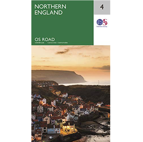
Description Northern England Road Map Northern England Road Map, from Ordnance Survey is a smaller-scale map for trip planning and touring this area of the United Kingdom. The OS Roadmaps series are single-sided folded maps. The 8 maps provide 1:250,000 scale coverage to enable the end user to navigate and plan their road journey. The maps include all motorways, primary routes and A roads for Great Britain, plus detailed tourist information including National Parks, Country Parks and World Heritage sites and a useful town and city gazetteer. Notable features on this map: Hadrian’s Wall Lake District Manchester Liverpool The Penines The eight maps in the series are Northern Scotland, Orkney & Shetland, Western Scotland and the Western Isles, Southern Scotland and Northumberland, Northern England, East Midlands and East Anglia, Wales/Cymru and West Midlands, South West England and South East England.