YIPPR.ES ≡ Torani Europe Maps Grassland Machinery Rochester Midland
  • Vintage Maps

  • Typus Orbis Terrarum Map Print

Typus Orbis Terrarum Map Print

$26.92 $51.69
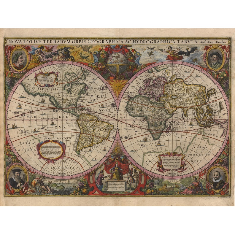
Description Typus Orbis Terrarum Typus Orbis Terrarum is a world map created by Abraham Ortelius, a cartographer from Antwerp in what was then known as the Spanish Netherlands. The map was first published in 1570 and demonstrates the extent of contemporary geographical knowledge, with recognisable forms for continents such as Europe, Asia, Africa, and the Americas. The lower part of the map shows a large, speculative land mass labelled as terra australis nondum cognita (“land of the south not yet known”). Printed on high-quality, 250gsm paper in fade-resistant inks.
Vintage Maps

Vintage Maps

  • Australia Tallis Map Print
    $36 $64.44
  • Thomas Scott Van Diemen’s Land 1824
    $36 $45.72
  • Jarman’s Map of Hobart Town 1858
    $12.54 $15.3
  • Nova Totius Terrarum Orbis Geographica
    $30.8 $54.82
  • Aboriginal Tribes of Australia Map 1940
    $24.12 $46.31
  • Hobart Town ‘Balloon’s Eye’ Sketch Print
    $21.86 $29.29
  • Port of Hobart – Deep Water Port Australasia Print
    $16.74 $31.81
  • Robinson’s Aeroplane Map of Sydney
    $21.07 $40.24
  • Antarctica 1939 Wall Map
    $23.91 $44.47
  • Typus Orbis Terrarum Map Print
    $26.92 $51.69
  • Freycinet Chart 1802
    $36 $46.08
  • Tasmania 1859 – James Sprent
    $18 $25.38
  • Van Diemen’s Island Tasmania 1851 Print
    $36 $53.64
  • Tasmanian Shipwrecks Map
    $11.96 $14.83
  • Map of the City of Hobart 1927
    $21.78 $26.57
  • Melbourne Bird’s-Eye View Print 1871
    $54 $95.58

© 2026 - YIPPR.ES